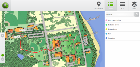
We have updated our CMS to upload simple 2D images as wayfinding maps. To use your existing drawings, just upload the image files under Floors page. If you have PDF-files You have to convert these into images (PNG, JPEG). We recommend to use at least more than 4096px images for situations where You need to zoom in.
We have added also a new free HTML5 template for 2D maps. Template is named Default2D, see the demo here:
https://static.3dwayfinder.com/projects/df85fafe2b5605ae7ab1f184e32a1caf/Default2D/

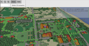
To add the locations and create paths for navigation, just use the Editor the same way as it works in 3D. After adding data to the maps, press “Update 2D navigation” button. This will generate the 2D data.

2D floor-plans don’t require WebGL support, so they can be used in all mobile devices and low-end kiosk PC-s. Creating wayfinding with 2D floor plans don’t require any special skills and you can always use existing images. If you like to go for 3D and you don’t have the 3D models, you can always order professional 3D floor-plans from us.
