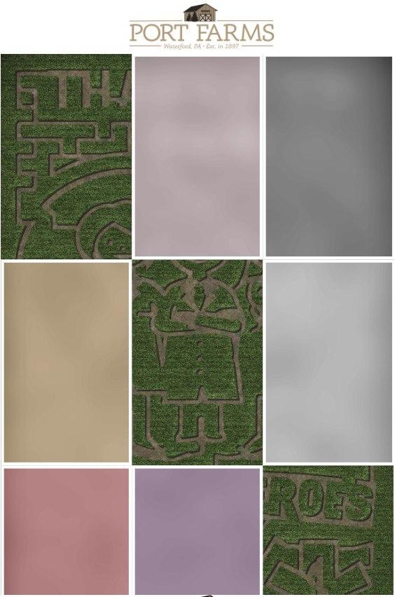
We have made a mobile-friendly web application for large corn maze. Application helps to navigate in the maze, but at same time it will not disappear the fun of finding the right path in maze. Continue reading to see, how that’s possible.
Our customer Port Farms is operating large corn maze in Pennsylvania, not far from Cleveland and Pittsburgh. The maze labyrinth will be updated every year and it is more than 500 feet in length and 300 feet wide.
We have created a web-based mobile application for Port Farms, with a map of the maze. When starting, the map tiles are not visible. At the entry point of each section, there is QR-code and by scanning the code a part of the maze map will open.

It is similar to strategic computer games, where you cannot see the whole map, but just the part you have discovered. By using 3D Wayfinder geolocation API, the actual location is shown by a red dot.
You may ask, why do you need to provide the map in maze or labyrinth at all? One thing is to wonder around the maze and finally get your way out. Another thing is to explore (and in some way we may even say to “conquer”) the maze and discover it. Without needing paper and pen, you just scan the QR codes and open up the map. But it doesn’t mean that you will see the right way through. You still have to try and guess.
3D Wayfinder with similar tiled maps can be used in any other maze, labyrinth or theme park. By scanning the code or following the link, you can add information layers to the map and get the needed info at the right location.
